Right off the bat, a few drone software development facts for you. Statistics show that by 2025, a) the global drone revenue is expected to grow to $63.6 billion; and b) drones are likely to create over 100,000 jobs. Additionally, the U.S. can boast of more than 800,000 registered units of the said aircraft, while drones themselves can boast of saving at least one life per week.
In other words, drones are everywhere, and they make a real impact on people's lives without them even noticing. That is why we decided to inspire you to create your own drone control app and share with you some insights on drone app development. So let's dive right in!
written by:
Maria Zhirko
Junior Software Developer
Contents
Drone Software Development: How Did It All Begin?
Technology is one of those things that only gets better with time. At first, it might not look like the doorway to the realm of new possibilities and appear to have a limited functionality, useful only for a handful of tasks. However, the more the world transforms, the more we begin to see. And the same thing happened to drones proving their exceptional value over time.
The first attempts to create drones, or unmanned aerial vehicles (UAVs), took place during the First World War under the wings of Britain and the U.S. Their prototypes showed big flight potential. Later on, Britain continued its research, and in 1935 produced the De Havilland Queen Bee aircraft model. It served as a target to train pilots of the Royal Air Force and turned out to be a big hit.
It goes without saying, that back then, drones were difficult to both construct and operate, so only governments had access to such technology. For a few decades these pilotless vehicles were used for surveillance and anti-submarine warfare purposes, until in the 1970s, authorities finally started to apply them for civil purposes in agriculture, construction, photography, and filmmaking. In the 1990s, drones became an integral part of search and rescue missions. Still, for common people, they were unreachable, expensive, and far too complex.
But in the same way as microwaves, televisions, and computers transformed from futuristic innovations into integral everyday gadgets, drones slowly became more accessible, too. In the 2010s, they gained popularity among businesses and those passionate about photography and videography, and gradually, a combination of a pilotless vehicle and a camera started to be more affordable to millions. After all, the design of these speedy miniature gadgets allows them to get everywhere, while for people the same task might be dangerous or physically impossible. Thus, to make the most of the drone design features, companies all over the world started to create drone control apps. They program the technology to complete all types of tasks that are hard for people, from monitoring climate change and emergency response, to oil and gas operations and delivering goods.
And just like that, these unmanned vehicles became ubiquitous, and the drone industry today is booming. The Grand View Research report states: the global commercial market for drones will grow at a CAGR of 57.5% between 2021–2028. Of course, drones wouldn't have achieved all of this on their own. They had allies, a.k.a. fellow technological innovations like machine learning. The same report says that machine learning algorithms “provide real-time, data-driven decision-making for their clients by enabling high-speed data capture, processing, and transfer.” Not bad for a flying vehicle equipped with a camera, huh?
Now that we know the UAVs' background, let's explore how drone software development transforms our lives on a daily basis.
Drone Apps: Taking a Look at Real-Life Use Cases
Drone Industry Insights, the world's leading drone market research and analytics company, keeps its hand on the pulse of the drone industry development and how various fields apply the technology. In 2022, they've established that, “14% of all drone applications take place within the Energy industry vertical, followed by 12% taking place in Construction, and 9% in Agriculture. Combined, these industry verticals represent more than one third (35%) of drone applications, meaning that those are the top drone applications in terms of industry.”
Since these are the top 3 fields that utilize the drone technology most of all, let's focus on how exactly they apply it.
Drone Programming to Make a Change in Construction
As Drone Industry Insights write, drones found the perfect niche in the construction industry to fill, which is mapping and surveying (the latter includes things like aerial planning, topographic mapping, inventory management, etc.).
The technology enriches businesses with the following benefits:
- Unmanned vehicles get the job done faster than people. This means that the workflow efficiency increases, while expenses go down.
- According to BigRentz, each year, 10.2 of every 100,000 construction workers suffer a fatal injury, which is the third-highest rate of any industry. With the drone technology that can replace people in dangerous tasks, the safety standard will grow.
- Drone hardware includes various sensors that allow them to capture data more accurately. As a result, construction companies obtain more quality information, which helps in decision-making and risk management.
It is no wonder that construction businesses worldwide actively use this technology to deal with various tasks and problems:
- In April 2020, DJI, a China-based leader in aerial photography systems, launched the Mavic Air 2 drone. It contains an 8 GB onboard memory storage and a 3,500 mAh battery, which enables a quality and long-term aerial photography process and video surveillance of residential construction sites.
- FLIR, a U.S. company, creates thermal and visible-light cameras for drones: they let businesses in construction gain complete awareness into after hours activity on the job site. The usage of a drone app that guarantees remote access to a construction site helps businesses stay on top of things even more.
- Airbotics, an Israeli drone operator and manufacturer, presents a whole package of services which includes an industrial-grade drone, an airbase, and software. One of the greatest features that they offer is automated intelligent flight modes. According to the company, the success rate of fully autonomous drone flights with no human intervention is 99.7%. This turns mapping missions that their drones actively complete to a bliss: there's no need to control neither takeoff nor landing, and you are free to pre-define or navigate the creation of terrain elevation maps. On top of that, their drone software development has come as far as enabling to measure quantities of on-site materials and perform site planning.
Drone Control to Transform the Energy Industry
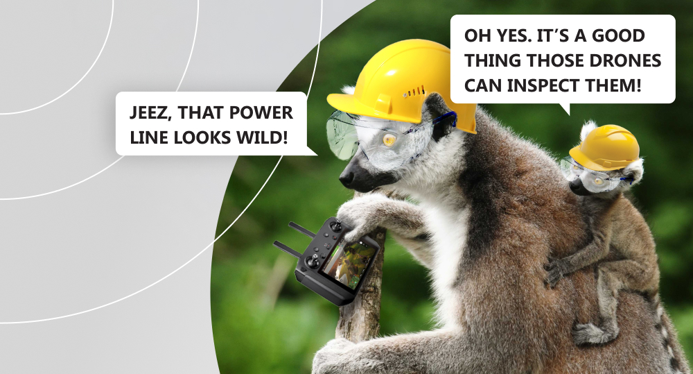
The energy industry is large, complex, and multifaceted. Flare stacks, oil rigs, wind turbines, industrial facilities, power lines — the list goes on and on. So does the list of inspections that must be carried out to ensure a) that we all have access to energy; and b) both the population and the environment are safe, since no system will suddenly malfunction. Consequently, inspections are the hottest topic of this field.
High temperatures, voltage, and velocity are constants there. Overseeing energy facilities is dangerous and requires a lot of human effort and time. But a drone equipped with the right set of embedded software technologies can completely change the game. Specialists get a chance to inspect any site from a safe distance, saving their time and companies' money on expensive work equipment.
- One of the companies that uses drones for inspection is General Electric. They apply the technology to work with power lines. Those are electrical hazards, mostly built in remote locations such as mountain chains or forests, and are perfect to delegate them to tech. Besides power lines, General Electric also works with wind farms.
- Industrial wind turbine blades are normally 115 ft (ca. 35 m) in length, with tower height that can exceed 250 ft (ca. 76 m). All in all, it's over 365 ft (0.11 km) of dangerous, meticulous work that today — luckily — can be entrusted to a metal thing, rather than a human being. As Sulzer Schmid, a Swiss drone company, writes, there are over a million rotor blades in the world to inspect, and drone solutions like theirs enable to capture reliable visual blade data. The company utilizes fully autonomous drones and proposes drone software to create reports using image analysis data. They say that “reports are generated at a push of a button, and with our interactive dashboards you can filter out any given aspect of the data to optimize performance and use our damage progression module to work towards predictive maintenance.”
- Another infrastructure that utilizes drones is oil and gas. Apart from everything else, Terra Drone, a prominent company with headquarters in Tokyo, conducts storage tank ultrasonic testing and confined space inspections. The former allows measuring the thickness of a metal wall or boiler tubes if those are made of steel/aluminum. As the company writes, “the drone is also equipped with a sand blasting mechanism which can blast the coating and painting, so there is no need for a deep cleaning prior to the inspection.” The latter enables drones to work with small spaces, even though we traditionally associate UAVs with wide open territories. On top of that, drone hardware is the key to incredible mobility in 3D, which means we can virtually access any place, “from any angle, regardless of the shape, material, and geometry of the environment.”
Consequently, the application of this technology results in such benefits as:
- Increased safety for workers;
- Ability to access hard-to-reach sites;
- Faster and more accurate inspection results;
- Heightened durability of energy objects, since businesses can spot and fix vulnerabilities in a timely manner;
- Cost-efficiency.
Agriculture Drone Software Development
The Earth population keeps growing. By 2050, we will have 2 more billion people, in addition to 8 billion of now. Nevertheless, food distribution is not even across the globe. Although technically there is enough food for everyone, with more people coming in, we might face a serious crisis since the global food production will have to increase by 60–100%. In theory, we could farm more land, but this solution is far from perfect: cutting down rainforests to grow more crop will lead to a climate catastrophe. Thus, the only real way to achieve the goal is to welcome innovations in the agriculture industry. This will help increase both the harvest quality and quantity since we will accurately measure, study, and manage crop cultivation.
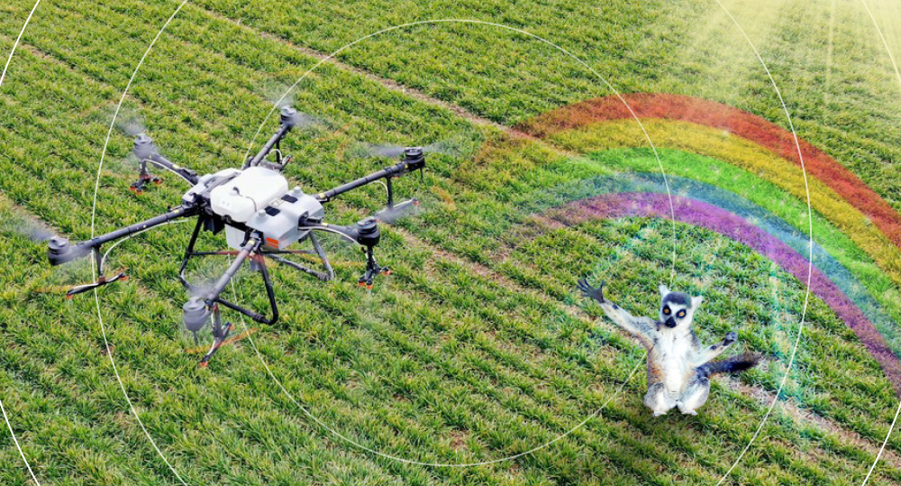
Agriculture is a very busy field: we need to count trees and livestock, monitor soil, plant seeds, analyze crops throughout acres of fields and spray them, collect soil and water samples, and keep the hand on the pulse of irrigation. Since these tasks require a lot of time, it gets progressively more difficult to keep fields safe and in good condition. However, drone software development has gone far enough to be able to perform all these tasks and more with higher speed and less waste. As Airborne Drones writes, “Smart farming drones come equipped with sprayers and ultrasonic echoing devices and lasers, which can measure distance with extreme precision. The result is a massive reduction in overall spray and a much lower chemical level reaching the groundwater.” They also state that drones can decrease the costs of planting by a staggering 85% (!) without the need for additional manpower. As to speed, such an approach would result at a plantation rate of 700–800+ plants per hour. With human labor, the same task would take approximately two days.
In other words, the benefits of drone application in agriculture include:
- Time- and cost-efficiency;
- An ability to recognize and troubleshoot issues before they get out of hand;
- Better data that derives from quality imagery;
- Heightened safety and health standards for farmers;
- Reduction of environmental impact through the usage of ULV (ultra-low volume) spraying technology, which means it saves water and overuse of chemicals.
Let's turn to a few use cases to help us realize the potential of drones in agriculture better:
- Gamaya, a Swiss company with focus on farming solutions and climate change, applies HSI (Hyperspectral Imaging) technology via drones to get remote access to sensors and capturing high resolution imagery. Farmers can use the image processing software solution to detect crop diseases, proliferation of invasive species, and environmental stresses.
- The aforementioned DJI offers a whole line of Agras drones that can cover the spraying needs of any field. For example, for larger fields, you can use the Agras T30, since it offers a 40 kg capacity, a flow rate of up to 50 kg per minute, a spreading width of up to 7 meters, and an hourly spreading capacity of 1 ton for urea. As the company states, “This translates to the ability to cover up to 40 acres per hour.”
- DroneDeploy, a U.S.-based celebrity of the drone industry, is truly committed to agriculture. Their drone technology offerings allow to map fields in minutes to conduct stand counts, identify variability, and make in-field recommendations, “all offline at the field's edge.” In 2021, they partnered up with Corteva Agriscience, a U.S. agriculture giant, to deliver scalable, in-field analytics to farmers globally. As Future Farming writes, "DroneDeploy leveraged Corteva’s machine learning algorithms to build its new Stand Assessment solution. Stand Assessment is a complete flight, capture, analysis, and reporting workflow designed to determine crop emergence for early-stage fields.”
As you can see from all the use cases above, although drone hardware has a big role to play, drone software development is what truly makes the wheel of the show spin. Hence, drone control apps lead to a myriad of opportunities to use the technology and transform the way the world works. Whether you're in the delivery business, want to receive reports on detailed weather conditions, or create a solution to make firefighting easier, there's a spot for you in the drone software development industry.
And if you're reading this, then you definitely know what kind of drone control app you want to build. So, let's take a look at how you can craft it! More specifically, we invite you to dive deep into the tech stack that can help you bring your idea to life and the core drone app features to implement.
Drone Control App: the Tech Stack
It goes without saying that you can build drone control apps from scratch. However, to save time and money, we invite you to explore the most popular drone application programming interfaces (APIs) and software development kits (SDKs).
SDKs are toolboxes with things like documentation, sample code repositories, and libraries that open the doors to writing applications for a specific platform to drone software developer teams. Usually, an SDK includes at least one API. APIs are crucial since they enable communication between the vehicle's onboard computer and a drone app and make sure that the applications you chose to integrate to yours are going to work together.
Here are the most popular SDK and API options in the market:
API/SDK
Description
DroneKit
It offers three main features: intelligent path planning, autonomous flight, and live telemetry. With this set, you can build drone control apps for Android, laptops, embedded computers, and web, since there are Android and Python APIs. DroneKit is free to use and drone agnostic: with its help you can craft apps for copters, planes, rovers, and blimps.
DJI Developer
This set for building drone software provides lots of features to add to your product. It allows controlling high- and low-level flights, determine the aircraft’s state via telemetry and sensor data, avoid obstacles, control the camera to photograph surroundings exactly the way you need, perform mission control, and others. You can use it for both Android and iOS development. DJI also has an additional SDK for supporting popular development models like Spark, Mavik, and Phantom.
Parrot
With this set, you get to stream data, download images or videos of the drone’s camera, send flight plans to autopilot, and work with other basic functions like drone update and drone control. Parrot's special offering is a drone simulation tool. With this SDI and API package, you can build a drone control app both for iOS and Android. It is free.
Drone App Development: What Are the Core Features?
The key functionality of your drone software depends on the field you're going to operate in, the tasks it's going to solve, and your drone app users, i.e., your target audience. Thus, we're going to list the core features, and you can add advanced features on top of those later on:
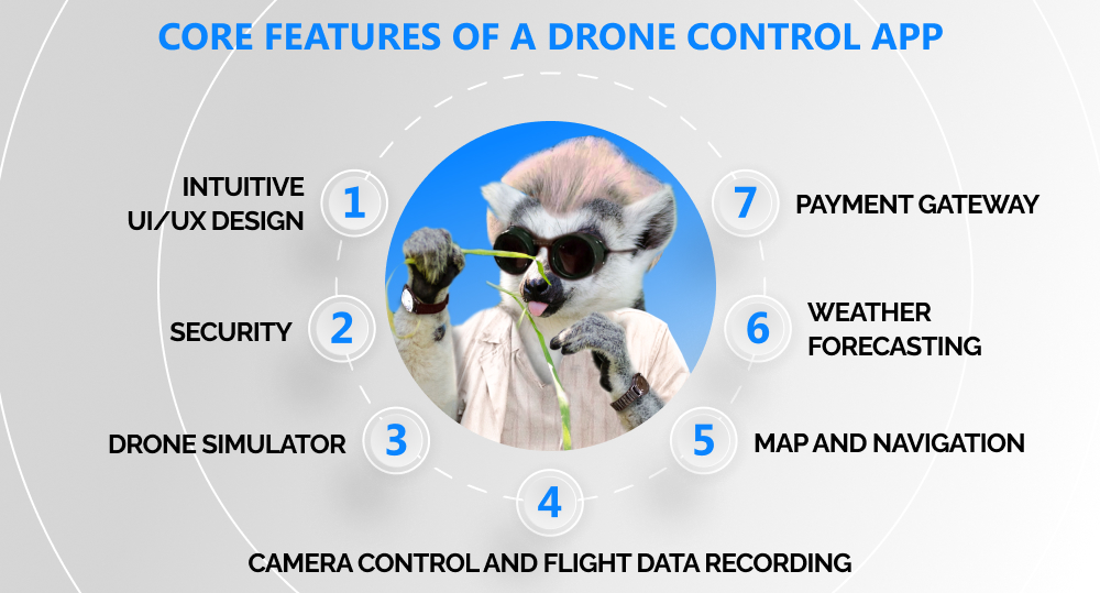
- Intuitive UI/UX design. If you make it clear what app features you're offering, and how to use them, both the business and the product's users will benefit from it. We're talking about the whole user journey, from the sign-up process (that has to be speedy and straightforward) to the way people can access data they've collected. Moreover, a thought through UI/UX will save time for your tech support team (and money for you), since with a self-explanatory app, the need to contact them disappears.
- Security. This is a huge thing for the drone software development industry, since it's all about filming stuff. Drone users need to be certain that no intruder will either get into their profile or access recorded content. Therefore, we recommend opting for multifactor authentication (MFA). You can offer users one-time codes, complex passwords, biometric verification, a message or phone call confirmation, and so on to protect their privacy.
- Drone simulator. Drone operators need to learn how to fly their vehicles and practice, which is safer and faster to do via a simulator. If you include this feature, you will save users from headache and make their experience smoother. After all, it's great if your product can solve an industry problem, but you also want to take care of those who are going to be at the forefront.
- Camera control and flight data recording. An ability to fly drones in various conditions is great, but that doesn't always mean it can collect high quality data, too. So, if a drone tracks good flight data regardless of the weather, that's even more of an advantage. Also, ensure that you provide enough data storage for flight log and grant easy access to the drone’s flying history. Apart from practical use, this information will help operators analyze their drone flying skills.
- Map and navigation. It might seem that constructing flying routes is the primary purpose of this feature. Yet it is responsible for something even more vital than being able to move your vehicle from A to B: data privacy laws. The drone application that you build has to provide guidance on how to operate the vehicle and steer clear from any rule violation, alongside the disruption of other people's privacy.
- Weather forecasting. This is a great addition to the key feature set of your drone control application. You can make it work through a weather API like AccuWeather API or any other option. It will help users decide if flying their drone to a specific location is worth it. Also, it would be useful to include tips on how to operate their vehicles in various weather conditions.
- Payment gateway. If you're going to offer paid services, such as add-on features or an app subscription, you need to integrate a payment gateway. Ensure its compatibility with different operating systems. It's also a good idea to offer multiple payment methods and check that transactions are quick and secure, since these factors also contribute to user experience.
Additionally, here are a few tips to keep in mind during the drone software development process:
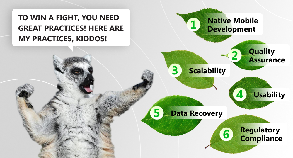
- Go for native mobile development rather than cross-platform development. Even though cross-platform apps are the new “it” of mobile apps since they are cost-efficient, nothing beats the seamless native user experience with its quality performance and security. Opt for an operating system that your target audience prefers, and in the future, you will be able to expand, armed with strong support of the existing community.
- Quality assurance is everything, so make sure your drone app's features work flawlessly on a variety of mobile devices. For that, check out Digital.ai, which is a web and mobile cloud testing lab with access to hundreds of real devices.
- Scalability, usability, data recovery, and regulatory compliance are the four whales that the drone control app journey bases on. So think beforehand about how you want to grow, whether it will affect your users, and what you can do to avoid possible bottlenecks.
FAQ
#1. What is drone software development?
That is the process of building drone control apps to allow vehicles to fly autonomously with self- and situational awareness.
#2. Does the creation of drone control apps require coding?
Yes, the creation of drone control apps typically requires coding knowledge and experience in programming languages such as Python, JavaScript, or C++, as well as knowledge of software development tools and techniques.
#3. How do you make a drone app?
Instead of building your app from the ground up, we recommend opting for a ready-to-use drone development tool, i.e., any set of SDKs and APIs. This will increase the time- and cost-efficiency of the drone software development process. You can choose from DroneKit, DJI Developer, or Parrot, which are all great options. To get some extra knowledge on how to achieve your goals, try a drone programming primer for software development. For this, you can turn to courses that Udemy offers.
#4. Can I make drone software using Python?
You can definitely create a drone control application with its help! DroneKit offers such an option with their DroneKit-Python.
#5. Which programming language is used in drones?
To craft drone apps from scratch, you'd need to use C, C++, and Python or Java.
#6. What software do drones use?
Drones use a combination of onboard and ground control software to control and monitor their flight, which can be supplemented with third-party software and software development kits provided by drone manufacturers.
#7. What are 3 industries that use drones?
The main industries that apply drones are construction, energy, and agriculture.
#8. How is drone technology used in agriculture?
It performs tasks like field monitoring, planting, seeing, and spray treatment, crop surveillance, and more.
Sky Truly Is the Limit
Whether you plan to create drone control apps for express shipping and delivery, conduct safety inspections, do crop monitoring, track storms, or forecast hurricanes and tornadoes, there's a spot for you in the drone research and development industry. So decide on the field you want to occupy, the features your unmanned vehicle should have, use a good set of SDKs and APIs to get quality and quick results, and soar up high!
If you have an idea of how to apply those tiny mechanical birds in the blue beyond best and need a proper drone control application, contact us! Our software developers know exactly how to make that happen.

Contacts
Feel free to get in touch with us! Use this contact form for an ASAP response.
Call us at +44 781 135 1374
E-mail us at request@qulix.com


